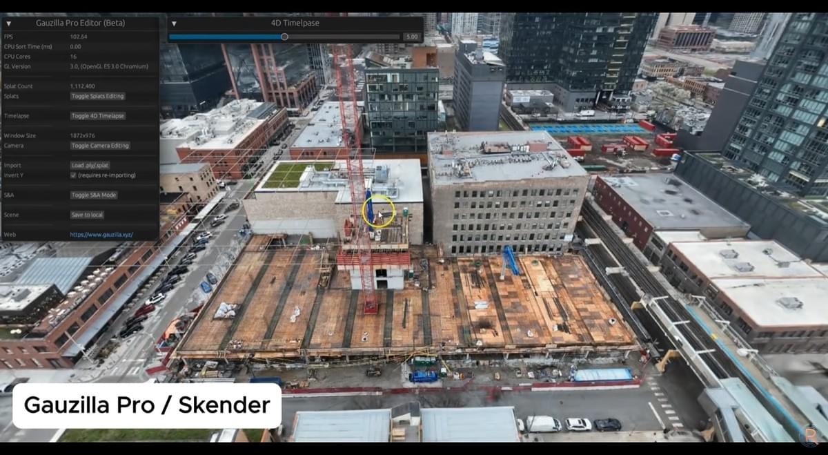
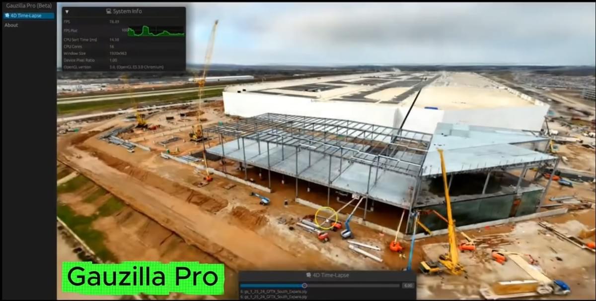


Gauzilla Pro
Turns any videos into AI-powered 3D/4D digital twins for AEC, Real Estate, and beyond
Gauzilla Pro allows for real-time, photorealistic rendering & editing of reality models captured with smartphones, aerial drones, 360 cameras, etc. Everything runs inside a browser. No installation required.
Demolition Planning & Verification in 4D
Dynamic 4D viewing & editing for demolition simulation, safety/logistics planning, and verification
Pre-Pour Inspection with AI
AI-powered 3D segmentation for detailed inspection and documentation to reduce disputes or rework
Vertical Construction Tracking in 4D
Powerful combination of 4D time-lapse and 3D segmentation for progress tracking and reporting
Facility Management (HVAC, MEP)
Intuitive selection & editing tool for quick and precise segmentation, annotation, and highlighting
Virtual Property Tours
Multiple air-ground scene fusions for showcasing existing or newly completed properties & facilities
Multi-Site Tours in City Scale
City-scale reality capture for multi-site virtual tours within the same city
Portfolio Management on a Unified Platform
A single unified web platform aggregating all projects locally on the map with seamless access

Accelerating Reality Capture Workflows with AI and NVIDIA RTX GPUs
AEC: Architecture, Engineering & Construction
Capture your jobsite in photorealistic detail and transform it into an AI-powered 4D digital twin that evolves with every phase of construction. High-fidelity reality models enable precise progress tracking against BIM schedules, early clash detection, and safer logistics planning—reducing rework, minimizing on-site risk, and keeping stakeholders aligned from groundbreaking to handover.
Real Estate
Give prospective buyers and investors an immersive, true-to-life 3D/4D experience of any property—anytime, anywhere. Gauzilla Pro delivers a level of visual realism that traditional as-built 3D tours cannot match, driving higher engagement, shortening sales cycles, and empowering confident purchasing decisions before a single physical visit takes place.
Mining & Forestry
Operate smarter across vast, dynamic landscapes by turning remote terrain into navigable and measurable AI-powered 3D/4D digital twins. Monitor stockpile volumes, track terrain/vegetation change over time, and plan extraction or harvesting operations with centimeter-level spatial accuracy, reducing costly site visits, and supporting environmental compliance from a single capture.
Heritage & Tourism
Preserve culturally or historically significant sites and landmarks as permanent, photorealistic 3D/4D digital records while opening them to global audiences. Immersive and interactive experiences let visitors explore heritage environments in extraordinary detail—fueling tourism engagement, supporting conservation research, and ensuring that irreplaceable cultural assets endure in digital form for future generations.
Oil & Gas
Digitize complex storage infrastructure and critical assets into inspection-ready, AI-powered 3D/4D environments that can be reviewed remotely and repeatedly. Identify corrosion, structural anomalies, and maintenance needs without shutting down operations or exposing personnel to hazardous conditions—streamlining compliance workflows, cutting inspection costs, and extending asset lifecycle through data-driven decision-making.
FAQs
What is the underlying technology?
What data will I need?
How should I capture a video?
Can I create 3D/4D scenes on-premise?
Can I create a georeferenced scene?
Powered by

Media Coverage

Free & Open-Source Basic Version
Gauzilla Basic is open-source and free-to-use (MIT license). You can host it on your website and load a 3DGS model from a URL.
Premium Pro Version
Gauzilla Pro offers an expanded suite of features tailored to meet the rigorous demands of businesses and professionals.
Register on the waitlist or contact us for early access.
Contact Us
Waldek Technologies
Waldek Technologies © 2026


